[ad_1]
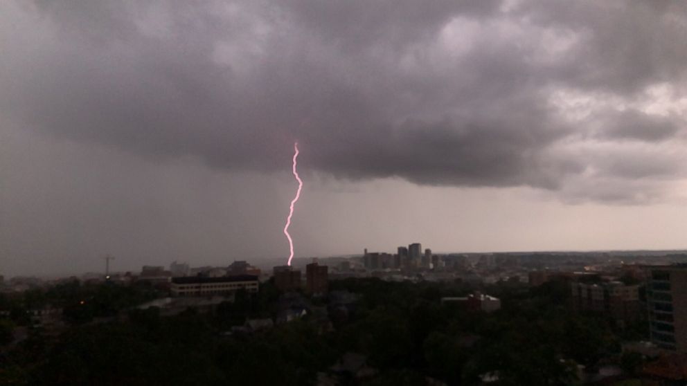
There will be a couple of different rounds of severe weather in parts of the central U.S. this weekend.
Interested in Weather?
Add Weather as an interest to stay up to date on the latest Weather news, video, and analysis from ABC News.
Storms are firing in parts of the Plains, where flash flood watches have been issued for parts of Kansas and Nebraska.
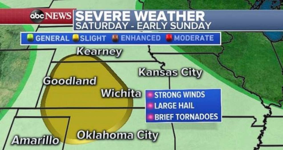
These storms should intensify later Saturday into Sunday in parts of the central Plains from Oklahoma to Nebraska. There is a slight risk for severe weather for this region, and there is a possibility of strong winds, large hail and some tornadoes.
 ABC News
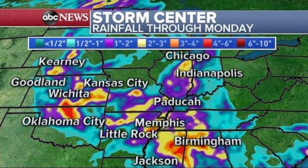
More storms should fire along this stationary front both Sunday and Monday as the system slowly begins to slide east. Storms could drop heavy rain from Kansas to Alabama, with 4 inches or more of rain locally through Monday.
Flash flooding could become a concern in some spots through the next few days in this region.
 ABC News
Monitoring the tropics
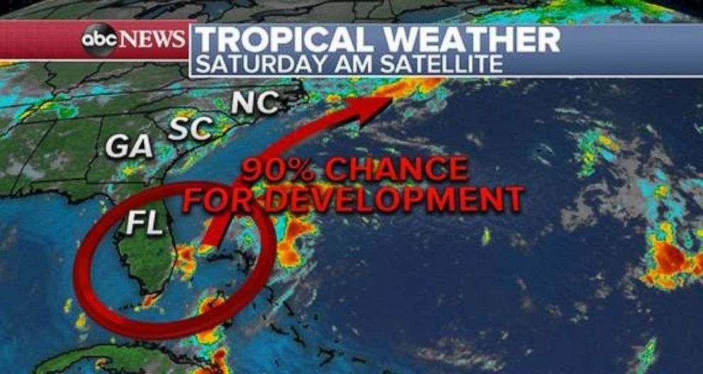
An area of low pressure over southern Florida Saturday morning is producing tropical rain showers along the Atlantic coast and into parts of the Bahamas. This system will struggle to organize and intensify Saturday, however, as it moves northeast on Sunday and Monday into the Atlantic Ocean it is likely to begin strengthening.
It appears that chances are increasing for tropical or subtropical development with this system as it moves into the Atlantic Ocean. It is possible it will become a tropical depression early next week. However, as the system moves northward it will meet a stationary front, which should protect much of the East Coast from a significant weather event.
 ABC News
There is a chance for some tropical rain showers to move toward the Carolinas early next week, but all major impacts form this system appear likely to stay off shore.
Taste of fall
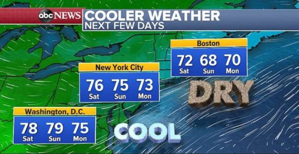
Meanwhile, in the Northeast, the dog days of summer have disappeared. Cool temperatures and low dew points are moving in from Canada and keeping temperatures below average with morning lows in the 50s and low 60s. Some 40 degree temperatures are even possible in parts of the interior Northeast and into Michigan. This is cool enough for many to need a light jacket and jeans Saturday morning — the first time several months.
Highs this weekend across the Northeast will be cool with temperatures stuck in the mid to low 70s.
 ABC News
Although this might be a taste of early fall for the Northeast, it’s important to remember September is a transitional month, where temperatures can be quite hot and also chilly.
[ad_2]
Source link

