[ad_1]
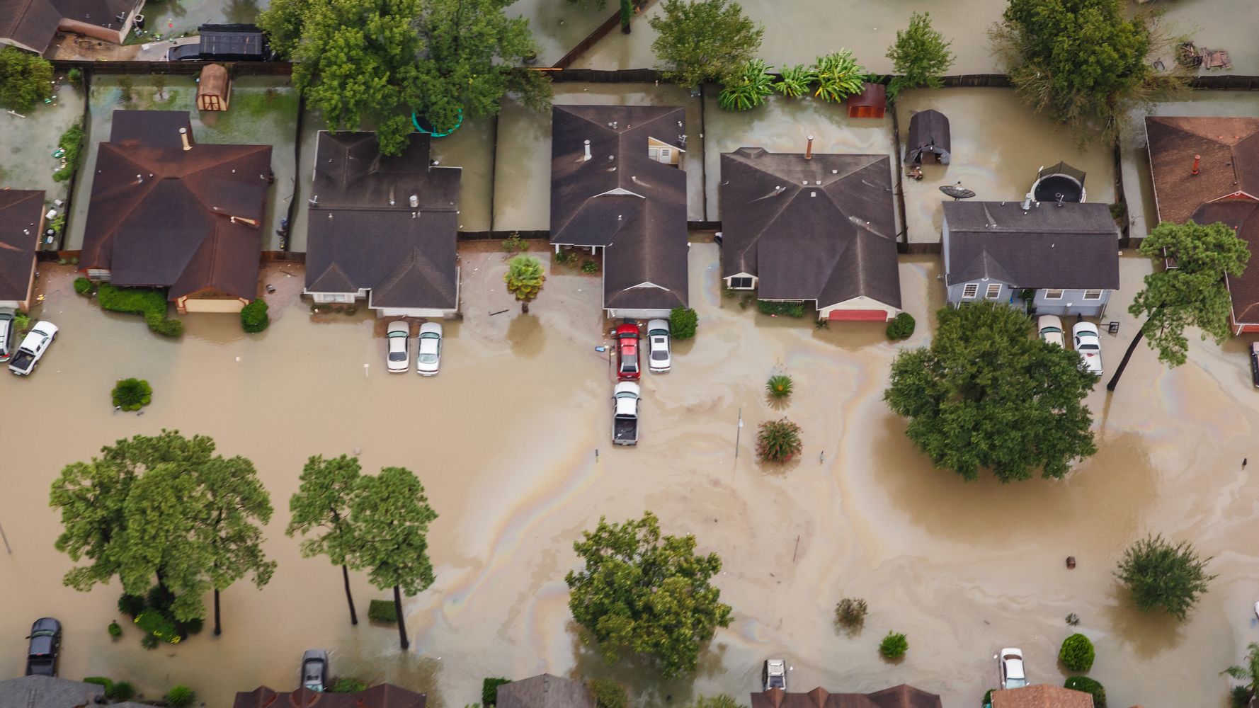
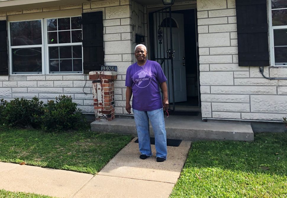
Doris Brown’s walls used to be covered in photos of graduations and weddings, memorabilia not only of her life but of her eight siblings, who all grew up in her house in northeast Houston. She managed to save most of the pictures when Hurricane Harvey submerged the house in floodwaters in 2017. But the mold the storm left behind rotted the walls. She decided to keep the new walls bare.
“There’s no sense in losing all of that again,” she said.
Nearly three years after Harvey, she and other longtime residents of her Houston neighborhood still live with the storm’s effects. One impact ― perhaps the one that surprises Brown the most― is all the new people who have moved in, buying up the destroyed houses that investors picked up for pennies, flipped and sold at a profit.
Developers have come for hers, too. She still gets calls and letters offering to pay cash, sometimes as many as 10 a day. Signs offering the same are scattered throughout the Scenic Woods neighborhood. But she’s not going to sell. Her mother, who bought the house in 1967 when Brown says there was just one other African American family in the neighborhood, made her children promise before she died that the house would never leave the family.
“If it’s nephews or nieces or whoever, somebody needs to be in this house,” Brown said in early March, as we sat in her bare-walled living room. Her own will leaves the house to her granddaughter. “We can’t go anywhere.”
The neighborhood had flooding problems when she was a kid, too. Now 70, with closely cropped gray hair and thick-rimmed glasses, Brown remembers watching the streets fill with water on stormy days and, once it had receded, searching the ditches for the crawfish left behind.
But the water had never risen high enough to come inside the house until Harvey.
In the years before the storm, which dumped 40 inches of rain on much of the area in a matter of days, the landscape surrounding the neighborhood had already been changing fast. In 2004, with the help of a grant from the city, a development company began transforming a once-forested area just north of Scenic Woods into a new subdivision, where the home-builder First America Homes later constructed a swath of single-family homes
Much of Harvey’s rain landed on concrete instead of the trees and grass that once would have absorbed it. Brown said that some of that water backed up in the drainage canal behind her house and overflowed into the street because the city had failed to keep the canal clear of trash. Just after Harvey, developers cleared another plot of forested land across the street from the first, making way for another First America Homes single-family home community.
In response to questions about the development, Greg Armstrong, the COO of The Signorelli Company, First America Homes’ parent company, emphasized that First America Homes was not responsible for clearing the land. The company did not respond to additional questions.
A year later, the streets filled up with water again when Tropical Storm Imelda hit, flooding some homes that had just been renovated.
At a civic club meeting after Imelda, Brown said that some of her new neighbors ― some Latino families who had recently arrived in Houston, some African Americans who’d been priced or flooded out of other parts of Houston ― expressed concerns about the flooding. They’d assumed that Harvey was just a one-time occurrence. They said that’s what the developers had told them, Brown recalled.
“They’d been sold a bill of goods,” Brown said. She and other longtime residents shared the history of flooding in the neighborhood and how poor drainage maintenance and new development had aggravated it. “That was a bitter pill to swallow.”
As sea levels rise and rainfall patterns change, homeowners and renters across the country are increasingly finding themselves and their homes at risk. According to a 2018 estimate from the Union of Concerned Scientists, as much as $1 trillion in coastal property could be at risk this century. More than 300,000 coastal homes totaling $117 billion in value could face chronic flooding over the next three decades.
These numbers do not begin to estimate the vast number of homes in inland cities like Houston, where historic rainfall and overdevelopment have rendered an aging flood management system of dams, levees, channels and detention ponds increasingly inadequate. According to estimates released this week from the nonprofit First Street Foundation, 186,481 properties in Houston are currently at risk of flooding ― that’s nearly a third of all properties in the city. By 2050, that number is estimated to grow to 202,317.
And yet, few people have access to the tools needed to assess those risks as they consider where to live. The tools that do exist at the national level are notoriously inadequate: The Federal Emergency Management Agency’s flood maps, the government’s most comprehensive resource on flooding hazards, rely on historical data rather than future predictions. Some use data dating as far back as the 1970s and ’80s. A 2017 Department of Homeland Security inspector general investigation found that 58% of all FEMA flood maps are inaccurate or out-of-date.
The new numbers from First Street offer an even grimmer picture, finding that FEMA undercounts the number of properties with substantial risk by nearly 6 million. FEMA classifies 8.7 million properties as falling within its “Special Flood Hazard Areas.” But First Street’s model ― which uses current climate data, including precipitation data, and covers areas FEMA has not even mapped, many of them inland areas like Houston ― finds the total is more like 14.6 million.
Hurricane Harvey put the limitations of the government’s maps into sharp relief in Houston: Almost three-quarters of the homes that flooded were outside FEMA’s floodplain. Because residents living outside the floodplain ― like Brown and many of her neighbors ― are not required to carry flood insurance, about 80% of Harvey’s victims had no coverage, rendering them ineligible for any significant disaster aid from FEMA. While the agency is updating these maps, funding cuts and opposition to the preliminary updated maps have slowed the process.
Brown, who has a long history of advocating for equity in Houston, feels like it’s been left to her to inform her neighbors of the risks. She started volunteering and now has a part-time position with the nonprofit that eventually replaced the walls of her house, West Street Recovery. She had lived in the mold-filled house for over a year, which aggravated her asthma and chronic obstructive pulmonary disease, before learning about the group.
She also connected with flood survivors across the city to form the Harvey Forgotten Survivors Caucus, which has been pressuring Houston officials to fix flood mitigation infrastructure. Last year, members of the group cleaned out their own neighborhood drains to raise awareness about the lack of city maintenance.
“They got all these billions of dollars and stuff, and it hasn’t trickled down to us yet. So we want to know, where’s our piece of the pie?” said Brown. “When do we get someone to come in and help other than a few-thousand-dollars offer to buy our houses out?”
Flood Risk Data Is Hard To Find
Even after spending years studying the bayous and watersheds of Houston, Sam Brody, a professor of marine and coastal environmental science at Texas A&M University, was at a loss for how to buy a house that wasn’t prone to flooding.
In 2017, he and his wife found their dream home in Houston’s upper-middle-class Larchmont neighborhood. It was a 1950s ranch house, close to good schools and at least a mile from the floodplain. The real estate agent told them it had never flooded. But as Brody drove through the neighborhood to the open house, he recognized the area from a photo he used in his lectures about urban flooding.
Brody and his wife eventually bought a different house on higher ground. Just a few months later, Harvey sent a surge of water through Larchmont, swamping the first floor of that dream house.
For Brody, the experience was a wake-up call: If the city had any hope of withstanding the more frequent and severe storms threatened by climate change, residents needed to know more about their flood risk.
“Why can you see your school rating on Zillow and your crime statistics on Trulia, but you can’t see your risk rating?” he said. He started working with a team at Texas A&M to build a flood-risk rating tool.
He’d spent years studying inscrutable FEMA maps, which show the risks at an area level rather than at the level of individual properties, and he knew accessibility needed to be a top priority. “Decision-makers can’t make sense of them. Homeowners don’t look at them,” he said. Very few prospective buyers have any sense of what they’re getting into.
Brody’s team broke the data down to the parcel level to create the interactive mapping tool “Buyers Be-Where,” which drew an average of 30,000 views per month not long after launching in 2018. But even that tool shares some of the FEMA maps’ problems, relying on outdated weather and storm data and unable to account for new development.
With help from the state, Brody’s team is now working to create a new tool that combines traditional hydrological models with data about flooding at the parcel level ― gathered from 311 calls, insurance claims and crowdsourcing ― into a machine-learning model. The goal is to predict the flood risk of every property in the 41 counties Harvey impacted.
Texas did introduce a flood disclosure law after Harvey requiring individual sellers to report if their home has flooded before. But its impacts are limited. The law doesn’t cover renters, and disclosure isn’t required until closing of a home sale, at which point few buyers are likely to change their minds. And there’s little assurance of the veracity of sellers’ disclosures.
For most buyers, the only signal they get about a property’s flood risk is the price. And in many cases, prices remain high across Houston’s booming housing market, even in risky areas.
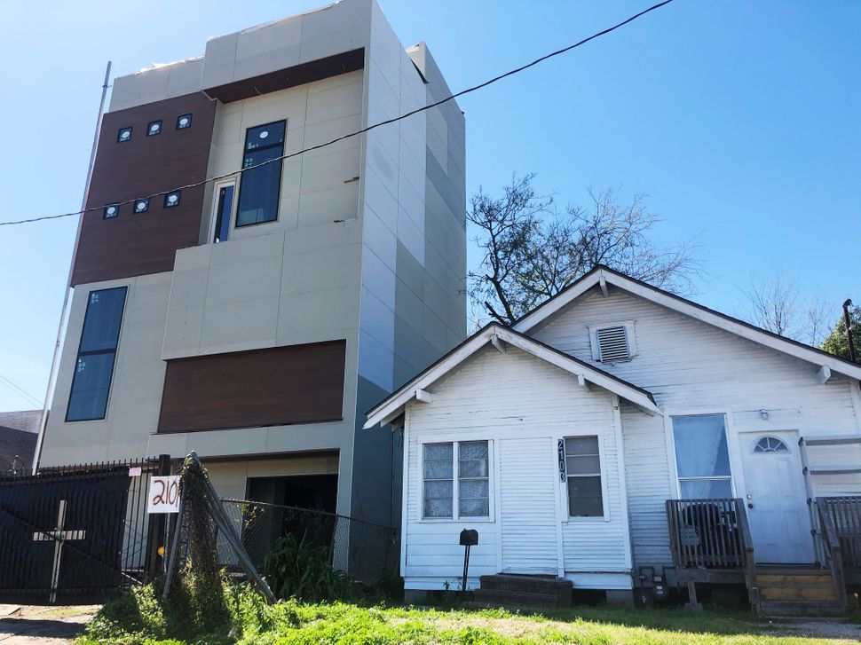
While some neighborhoods in Houston took a price hit after Harvey, many have since rebounded. Real estate agents advertise homes as “never flooded” to keep prices high, even if the home just next door did flood. At the same time, developers continue to build in the outer reaches of the city highly vulnerable to flooding, like Brown’s neighborhood, which is driving up prices.
“The market tends to be very shortsighted and thinks in a three-to-five-years timeline at best,” said Rachel Cleetus, policy director with the climate and energy program at the Union of Concerned Scientists. “Just relying on the markets can create these frankly irrational outcomes where there can be very short-term gains that a certain set of people can make at the expense of others.”
And while real estate agents and developers may be able to turn a profit before the next storm, buyers are stuck. The floods that threaten cities like Houston could hit “well within the lifetime of a typical mortgage issued today,” Cleetus warned.
As the risks of unabated floodplain development are becoming clearer, others are undertaking efforts like Brody’s. First Street Foundation’s new search tool overlays property-level data, building footprints, and flood hazard layers to calculate the past, current and future flood risks of every property in the country. The nonprofit news outlet Climate Central announced the release of a similar tool in March, which will show the risks of any coastal location in the world.
“The thing that we are trying to do is provide the market with a level playing field of data around what for the vast majority of Americans is their most valuable asset and the biggest purchase they’ll ever make in their life,” said Matthew Eby, executive director of First Street Foundation.
An $8 Billion Dollar Consulting Market
The unevenness of that playing field is becoming more obvious as climate risks increase. A 2017 study from researchers at the University of Colorado at Boulder and Pennsylvania State University found that homes exposed to sea level rise sell for approximately 7% less than equivalent unexposed properties. That report also found that it was most often “sophisticated buyers”— real estate investors who tend not to live in the properties they buy ― that paid the lowest costs. People who actually planned to live in those homes continued to pay higher prices.
Another recent study published by Cornell University found a similar trend in commercial real estate, where professional investors bid down the prices of higher-risk properties.
And similar trends are emerging in fire-prone areas. After the recent historic fires in California, fire insurance agencies started using data from new “insurtech” startups that combine artificial intelligence with high-resolution satellite imagery to provide companies with property-by-property data. Insurance companies rapidly dropped thousands of homeowners in areas affected by the fires — an increase in insurer-initiated non-renewals of 10% between 2017 and 2018 — before the state passed a temporary moratorium on doing so.
Firms are charging exorbitant yearly subscription fees for access to this kind of risk data.
“The bigger players are definitely hiring firms whose primary order of business is to interpret climate change risk at a portfolio scale and translate that into revenue and bottom-line implications,” said Joyce Coffee, president of Climate Resilience Consulting, which works with cities, nonprofits and private companies.
By 2026, the global climate change consulting market is forecast to be worth $8 billion.
Without a parallel expansion of public access to risk information, Coffee anticipates an “unmanaged retreat” from risky neighborhoods shaped by who has access to the data.
“We would want to level that playing field as much as we can if we want a fair and equitable society, and therefore make risk information as widely available as we could to support that,” said Steven Flynn, director of the Global Resilience Institute at Northeastern University. “In theory, every good capitalist should be behind that, yet obviously we know that people are invested in that asymmetry and get a profit advantage by operating on an uneven playing field.”
‘All This Was Lost Because They Had No Time’
But in a city like Houston, many residents face a bigger challenge than just access to data: They have nowhere else to go.
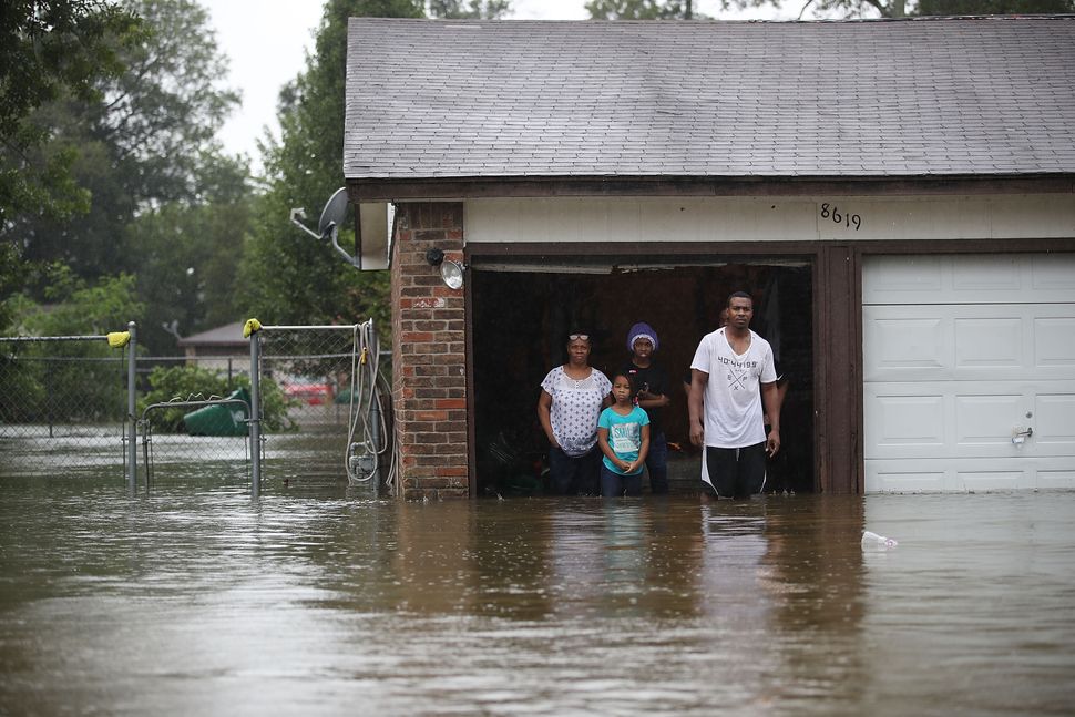
A few weeks after Harvey’s waters receded, Rev. James Caldwell led a group of community organizers through the apartment complexes of northeast Houston to survey the damage. Some places had seen as much as six feet of water and their residents had to be evacuated by boat. Pictures of their grandchildren and graduations still hung on the walls.
“They left everything,” said Caldwell, who runs the Coalition of Community Organizations, a grassroots group serving the northeast Houston neighborhoods of the 5th Ward and Kashmere Gardens where he grew up, and also serves as a minister at Community House of Prayer, a small, nondenominational church in the 5th Ward. “All this was lost because they had no time.”
The people who lived here didn’t have the resources to move elsewhere, Caldwell said. “I’d say 95% cannot afford to move out of a flood-prone area to a non-flood-prone area,” he said.
Many ended up moving into similarly vulnerable areas after Harvey, to places like Brown’s neighborhood.
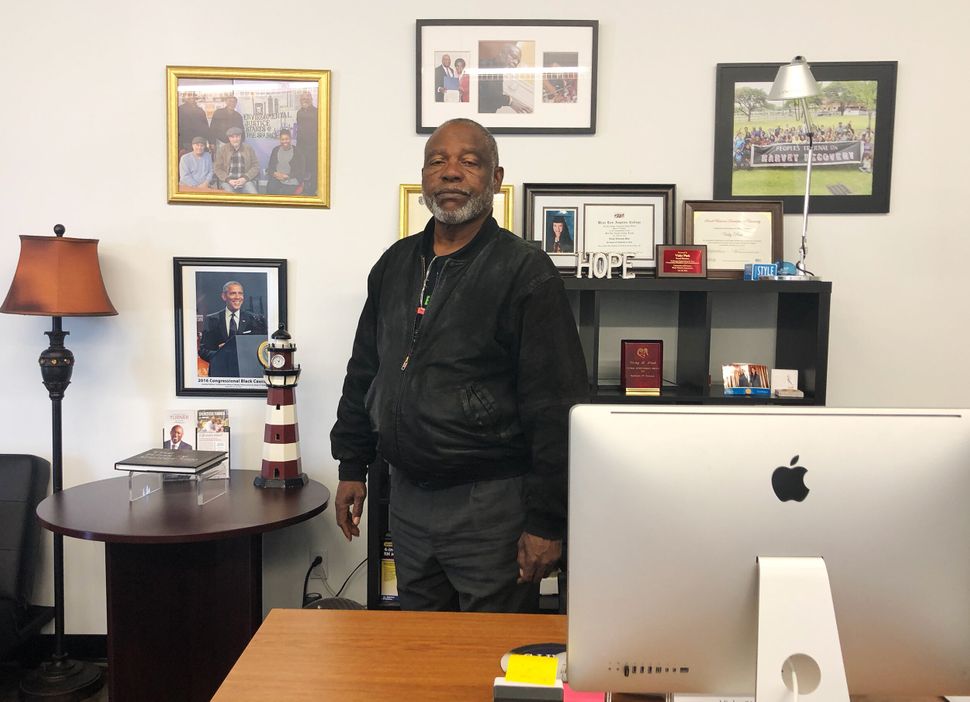
Caldwell worries that widespread availability of flooding projections could cause further harm to at-risk communities by driving down property values. “The mitigation and those maps and all of the plans that they have as well as far as the next flooding event — who does it benefit and who benefits from it?” he asked. “Whose property value are we talking about?”
Cleetus, of the Union of Concerned Scientists, also worries about what declining property values will do to already vulnerable communities. Lower property values means less local property tax revenue, which is used to fund schools, flood mitigation infrastructure and emergency services, among other things.
“Especially in places that are identified as high risk, that kind of puts a bull’s-eye on people’s properties and communities,” said Cleetus. “If you don’t have the resources, then it’s just a terminal diagnosis.”
Similar fears are shaping federal policy. In March 2019, FEMA announced it would be releasing a revised mapping system in 2020 that would show the flood risks of individual homes rather than whether a home sits within a 100-year floodplain. The agency later pushed the release date back by a year citing concerns about “unintentional negative effects.” If new maps reflect actual risk, the agency acknowledged, insurance rates could become cost-prohibitive for many in vulnerable areas.
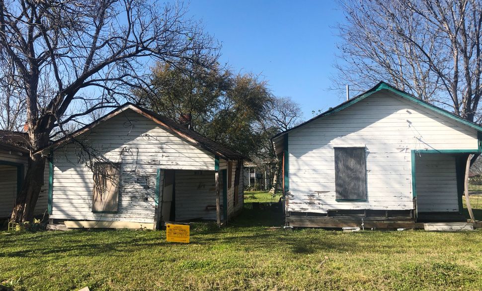
Cities have already begun contesting the revisions. When FEMA released preliminary versions of the new maps in 2015, New York City successfully challenged them out of concern that the new maps would make flood insurance unaffordable and prompt a foreclosure crisis in the city’s riskiest areas.
It’s a Catch-22 that many risk experts say eludes easy answers.
“The point of the process is to drive down home values in risky areas so that people think those areas are less desirable so that we get less development,” said A.R. Siders, a professor of climate adaptation at the University of Delaware. “But there are huge problems with this, of course.”
Siders worries that lower prices in risky areas will drive lower-income people into those homes, putting those with the fewest resources to recover from a disaster in harm’s way.
It’s not so different from how Brown and her neighbors ended up in northeast Houston in the first place. The edges of the city, plagued by persistent flooding and poor drainage maintenance, were the only places their families could afford.
“It was gentrification that started it all, when they said that they wanted to expand downtown and took all of our neighborhoods and all our properties,” she said.
Brown remembers as a young teen when she would play hooky from school to join civil rights sit-ins at the Woolworth’s downtown.
“The fight has continued all along ― it’s never really ended,” she said. “It’s always one thing or another.”
Calling all HuffPost superfans!
Sign up for membership to become a founding member and help shape HuffPost’s next chapter
[ad_2]
Source link

