
[ad_1]
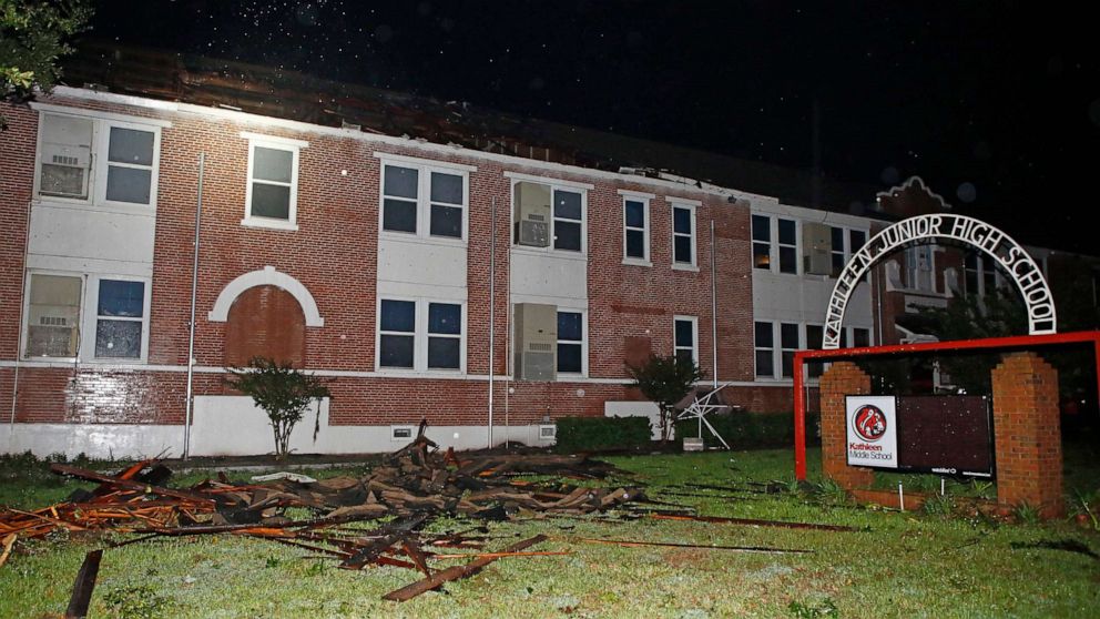
Nestor made landfall on Saturday in St. Vincent Island, Florida as a Post Tropical Low Pressure System. There were 7 reported tornadoes on Friday night and Saturday as the outer bands of Nestor moved into Florida and Georgia.
Interested in Weather?
Add Weather as an interest to stay up to date on the latest Weather news, video, and analysis from ABC News.
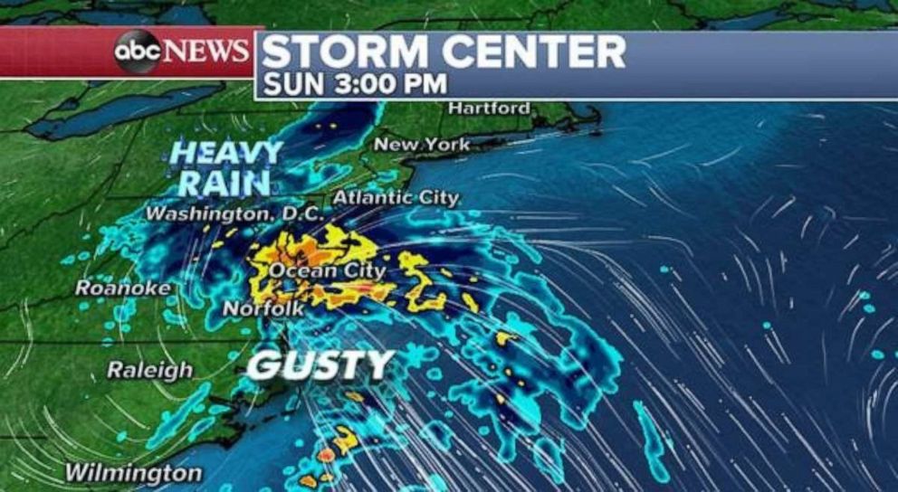
Nestor is now just a classic low pressure system as it moves through the Southeast and towards the mid-Atlantic this morning. A fairly large rain shield is currently covering much of North Carolina and Virginia, with pockets of heavier rain and some gusty winds.
 ABC News
The low pressure will begin to be pushed eastward later this morning and early afternoon. However, a couple of bands of heavy rain and gusty winds could move into parts of Maryland, Delaware and New Jersey — especially from Ocean City to Atlantic City. The low pressure will be pushed out to shore this evening and tomorrow, with impacts to the rest of the northeast being kept to a minimum.
However, as the low pulls away, some gusty winds can be expected in parts of New England on Monday.
Elsewhere, a new storm that brought some rain, snow, and strong storms to Pacific Northwest on Friday and Saturday has already moved across the Rockies this morning.
Behind the storm some mountain snow is falling across parts of Colorado, Wyoming, Montana, and Idaho.
 ABC News
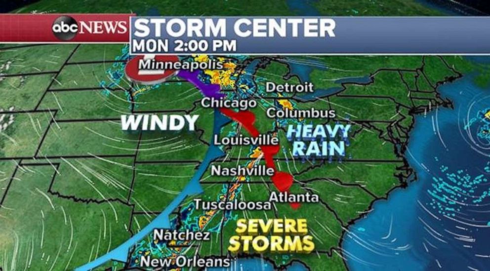
On Monday, a strong frontal system will push the storms into the Mississippi River Valley. There will likely be a very long line of storms along the front, with some stronger cells embedded in the line, especially across parts of Arkansas, Louisiana, Mississippi and Alabama.
Unfortunately, behind this developing storm system there are two other areas of weather concern. One of them is a risk for fires across the high plains from Western Kansas to Eastern New Mexico. This is due to strong gusty dry winds behind the cold front.
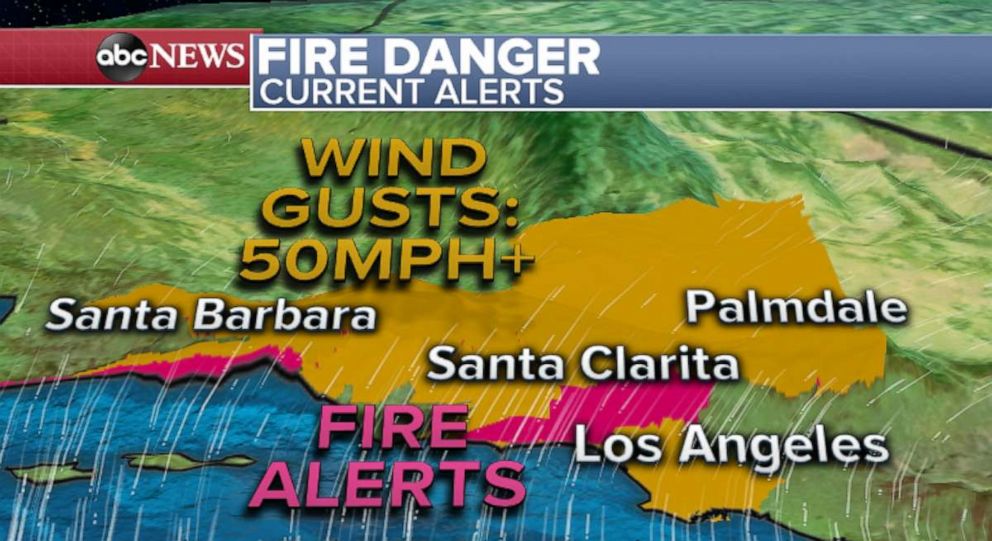
The other is in Southern California where another Santa Wind event is getting underway. Strong winds, locally over 50 mph will be possible in the Los Angeles metro area today. In some of the mountain, winds could gust as high as 75 mph.
 ABC News
Unfortunately, these dry Santa Ana winds coming over the mountains and into the Los Angeles area will bring an elevated fire threat to the region. Any fire that develops will be able to rapidly spread. A strong Santa Wind Event looks possible later this week as well.
[ad_2]
Source link