

[ad_1]
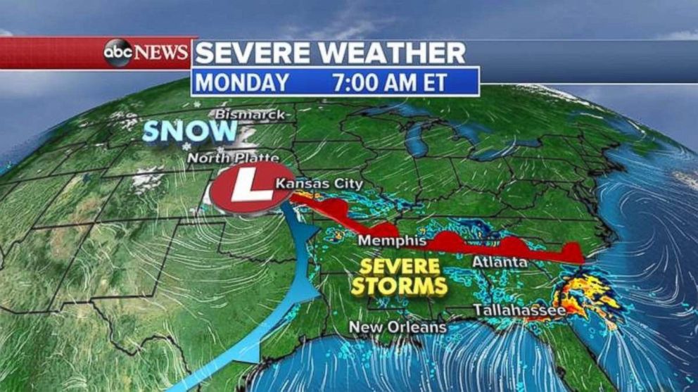
A large storm system is moving through the Great Plains on Monday morning bringing unsettled weather from the Dakotas all the way to the southeastern United States.
Yesterday, more than three dozen damaging storm reports were made, most of them in east-central Texas where hail was larger than a baseball. There were also two reported tornadoes in the Texas panhandle and winds of 60 mph or greater in eastern Texas.
On the northern side of the storm, heavy snow fell around Denver, with anywhere from 5 to 10 inches overnight in the metro area.
The storm system is moving east Monday, and is now stretching from the Northern Plains to the Gulf Coast. To the north, snow is falling in the Dakotas while tornado warnings have been issued for part of the Florida panhandle.
 ABC News
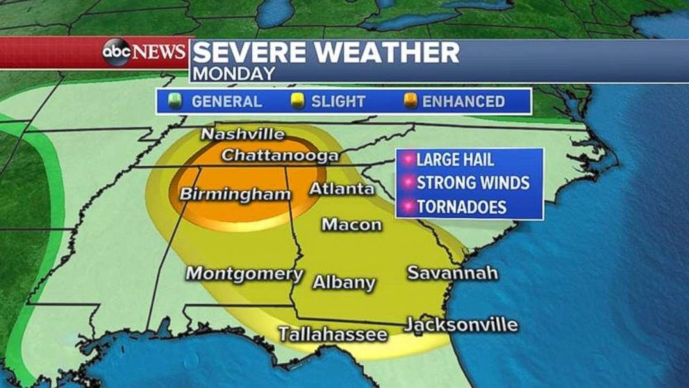
The storm system will move further east Monday afternoon, and will pick up moisture from the Gulf of Mexico. Severe storms will break out from Jacksonville, Florida, to Atlanta; Birmingham, Alabama; and into Nashville, Tennessee.
The biggest threat will be huge damaging hail, tornadoes and wind. Flash flooding is also possible.
The biggest threat for tornadoes will be from Nashville to Birmingham and just west of Atlanta this afternoon and evening.
 ABC News
Developing in the East
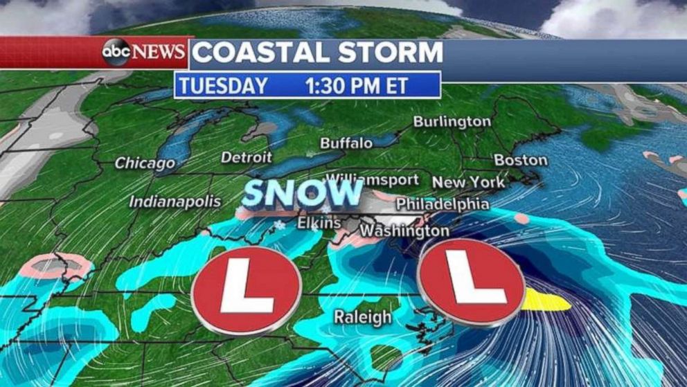
As the storm moves east on Tuesday, a coastal low will try to develop in the southern Mid-Atlantic states producing a first wave of rain and snow from Washington, D.C. north into Pennsylvania and west into West Virginia. Several inches of snow is possible just west of Washington, D.C.
 ABC News
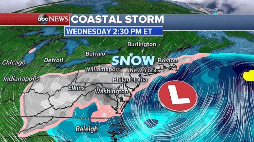
By Tuesday night into Wednesday, as the coastal low strengthens, it will produce a second wave of rain and snow, spreading along the I-95 corridor from Washington, D.C. into New York City and Boston.
Models are still not very confident where the low will form and how much snow or rain will fall in the heavily populated I-95 corridor. If major cities get precipitation, it would be mostly be on Wednesday.
 ABC News
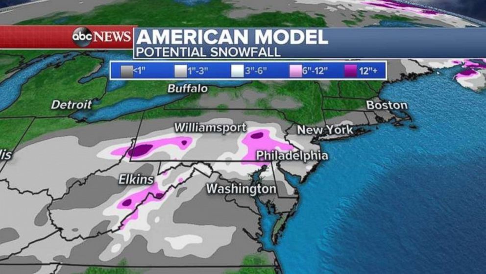
The American model isn’t showing much snow for the major cities — maybe a dusting to 1 to 2 inches on Wednesday.
 ABC News
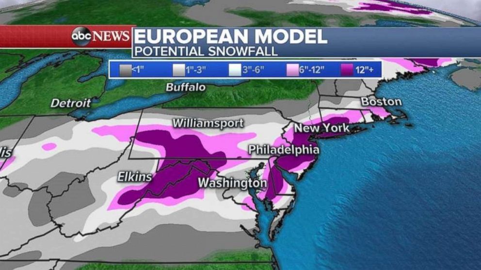
The European model has a different forecast with heavy snow accumulations for the major Northeast cities, but ABC News meteorologists predict the model is probably overdoing these amounts.
 ABC News
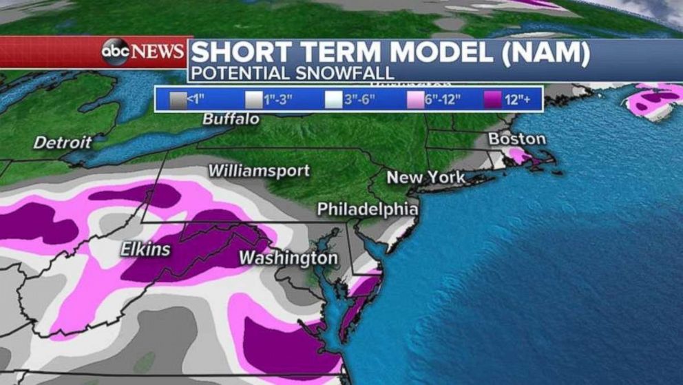
The short-term American model is showing the storm missing Washington, D.C., Philadelphia and New York City, with maybe some snow accumulations along the Mid-Atlantic coast and into Cape Cod.
 ABC News
It could go either way, but confidence is growing that some sort of storm system will form along the East Coast.
[ad_2]
Source link